Key Takeaways
- A boundary survey defines where your property lines legally fall; a topographic survey maps the shape, elevations, and features of the land; an ALTA/NSPS survey combines both with title and ownership details for commercial transactions.
- Choose a boundary survey for fences, additions, and property line disputes; a topographic survey for design and permitting; an ALTA survey when a lender, title company, or investor requires it.
- In Lafayette and across Acadiana, the right survey depends on what decision the data must support — building, buying, financing, or resolving a dispute.
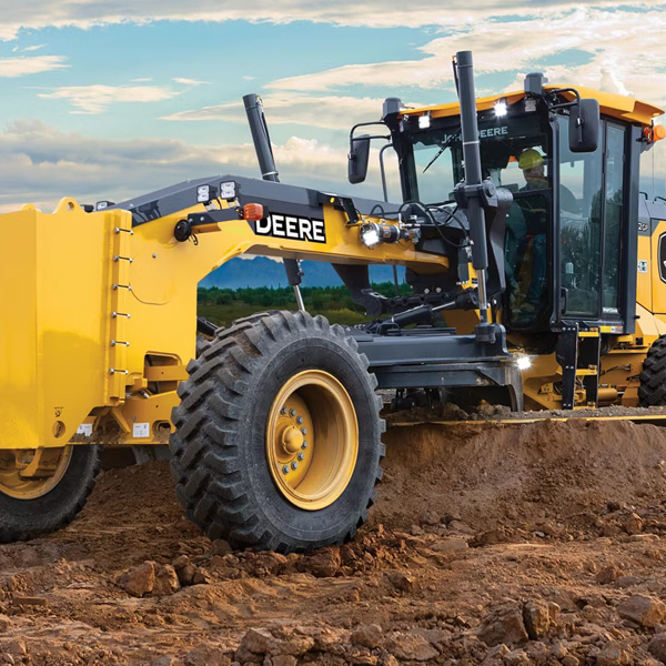
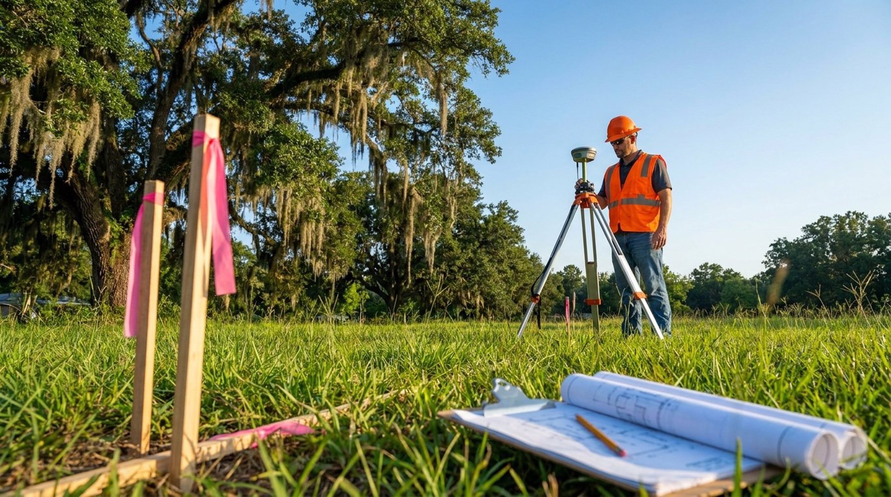
- All three are performed by a Louisiana-licensed Professional Land Surveyor and rely on the same field equipment: RTK GNSS receivers and robotic total stations.
"What kind of survey do I need?" is one of the most common questions a land surveyor in Lafayette hears. The terms boundary, topographic, and ALTA get used interchangeably by people outside the profession, but they describe very different products with different purposes, costs, and turnaround times. Ordering the wrong one wastes money and time — and sometimes leaves you without the document a lender or permit office actually requires. This guide explains what each survey delivers and how to choose the right one for your project in South Louisiana.
What Is a Boundary Survey?
A boundary survey establishes the legal perimeter of a parcel — the exact location of every property corner and the lines that connect them. The surveyor researches the deed, prior plats, and adjoining records, then recovers or sets physical monuments (iron rods or pipes) at each corner. The result is a plat showing dimensions, bearings, acreage, and any encroachments or easements that affect the property.
This is the survey you need when you are installing a fence, building close to a property line, subdividing land, or settling a disagreement with a neighbor. In Lafayette Parish and communities like Broussard and Youngsville, boundary surveys are essential before any improvement that could cross a line or violate a setback. Because it carries legal weight, a boundary survey in Acadiana must be signed and sealed by a Louisiana-licensed Professional Land Surveyor.
What Is a Topographic Survey?
A topographic survey maps the three-dimensional character of a site — elevations, contours, and the location of natural and man-made features such as trees, ditches, utilities, slabs, and drainage structures. Rather than answering "where are my lines," it answers "what is on this land and how does it sit." The deliverable is a detailed map engineers and architects use to design buildings, grading, and drainage.
You need a topographic survey before designing a new home, a commercial pad, or a stormwater plan. In flood-prone parts of South Louisiana, accurate elevation data is critical — it drives how a site drains and whether a structure meets base flood elevation. Modern crews capture this data with RTK GNSS, robotic total stations, and increasingly with drone photogrammetry and laser scanning, which collect millions of points across a site far faster than ground methods alone. For a deeper look at how aerial methods fit in, see our overview of drone and aerial surveying.
What Is an ALTA/NSPS Survey?
An ALTA/NSPS Land Title Survey is the most comprehensive option, built to a national standard set jointly by the American Land Title Association and the National Society of Professional Surveyors. It combines a boundary survey with extensive detail about easements, rights-of-way, encroachments, zoning, and improvements, all cross-referenced against a current title commitment. The standard includes an optional "Table A" list of items the client can request, such as flood zone notation, parking counts, or utility locations.
ALTA surveys are typically required for commercial real estate transactions — when a property is being bought, sold, financed, or developed and a title insurer or lender wants certainty about exactly what is being insured. If you are acquiring a retail center in Lafayette or refinancing an industrial site near New Iberia, the lender will almost always specify an ALTA survey. It costs more and takes longer because of the title research and breadth of detail involved, but it is the document that satisfies institutional due diligence.
Boundary vs Topographic vs ALTA: How to Choose
The simplest way to choose is to start with the decision the survey must support. A boundary survey answers questions about ownership and lines. A topographic survey supports design and engineering. An ALTA survey supports a financed commercial transaction and merges the other two with title information. Many projects need more than one — a developer might order a boundary survey to confirm acreage, then a topographic survey to design the site.
- Putting up a fence or resolving a line dispute? Order a boundary survey.
- Designing a home, drainage, or grading plan? Order a topographic survey.
- Building or refinancing a home and need elevation data for flood compliance? A topographic survey, often paired with an elevation certificate.
- Buying, selling, or financing commercial property? Order an ALTA/NSPS survey.
When you are unsure, describe your end goal to the surveyor rather than naming a survey type. Telling the firm "I'm adding a garage and need a permit" or "my bank is requiring a title survey" lets the professional recommend the correct scope. Pioneer Surveying works through this exact conversation with property owners and developers across Acadiana every week, scoping the smallest survey that fully answers the question at hand.
What Affects Cost and Turnaround in South Louisiana
Cost and timeline scale with scope. A boundary survey on a single residential lot is the most affordable and fastest of the three. A topographic survey takes longer because of the volume of field data collected, and an ALTA survey is the most involved due to title research and the breadth of the national standard. Parcel size, terrain, vegetation, the quality of existing records, and how many corners must be recovered all influence the final number.
South Louisiana adds its own variables. Dense vegetation and standing water in Acadiana can slow field work, and properties with old or conflicting deeds require deeper records research. Using aerial and scanning technology where appropriate helps control both cost and schedule on larger sites. For a detailed breakdown of pricing factors, see our guide on what a land survey in Lafayette typically involves, and call ahead so the firm can give you an accurate scope-based quote.
Frequently Asked Questions
What is the difference between a boundary survey and a topographic survey?
A boundary survey locates and marks your legal property lines and corners, answering where your land begins and ends. A topographic survey maps the elevations, contours, and physical features on the land for design and engineering. One defines ownership; the other describes the terrain.
Do I need an ALTA survey to buy a house in Lafayette?
Usually not. ALTA/NSPS surveys are designed for commercial transactions where a title insurer or institutional lender requires them. For a typical residential purchase in Lafayette, a boundary survey — and sometimes an elevation certificate for flood insurance — is generally sufficient.
Which survey do I need before building a new home?
Most new-construction projects in Acadiana need a boundary survey to confirm lines and setbacks plus a topographic survey to support the site, grading, and drainage design. In flood-prone areas, an elevation certificate is often added to verify compliance with base flood elevation.
Can one survey serve more than one purpose?
Yes. An ALTA/NSPS survey inherently includes boundary work and can incorporate topographic detail through its optional Table A items, making it a combined product. Many firms can also deliver a combined boundary-and-topographic survey when a project needs both at once.
How accurate are these surveys?
All three rely on survey-grade equipment — RTK GNSS receivers and robotic total stations — that achieve horizontal accuracy on the order of a few hundredths of a foot on most sites. Accuracy is governed by Louisiana licensing standards and the professional judgment of the licensed surveyor.
Get the Right Survey for Your Project
Choosing between a boundary, topographic, or ALTA survey comes down to the decision you need the data to support. If you are still unsure which one fits your situation in Lafayette, Broussard, New Iberia, or anywhere across South Louisiana, the team at Pioneer Surveying can help you scope it correctly the first time. Call (337) 443-0955 or reach out through our contact page to discuss your project and get a clear, scope-based quote.